
Best Day Hikes Near Denver: Forget The Tourist Traps. Here’s The Real Dirt.
Look, you’re in Denver. You want out. You want mountains, damn it. Not some crowded, Instagram-filtered garbage. You want grit. Sweat. Views that’ll punch you in the gut. The thing is, finding those spots ain’t always easy. Denver’s exploded. Every hack with a Tesla thinks they’re a damn mountaineer now. So, let’s cut the crap. This ain’t your grandma’s gentle stroll.
We’re talking about the Best Day Hikes Near Denver. The ones that make you earn it. The ones with actual dirt under your nails, not just overpriced craft beer fumes. I’ve pounded these trails. I’ve sweated on ’em. I’ve cursed ’em. And I’m goa tell you where to go. No fluff. Just the raw truth.
Forget those articles listing hikes you can see from your car. This is for people who want to feel something. Who want to escape the city’s fake cheerfulness and find some damn peace. Or maybe just get a serious workout. Either way, we got you.
The Big Lie: ‘Easy’ Hikes Near Denver
Everyone screams ‘easy!’ and points you to a paved path through a strip mall parking lot. Bullshit. Even the so-called ‘easy’ hikes near Denver can kick your ass if you’re not used to altitude. Denver sits at 5,280 feet. That’s a mile high, folks. You breathe different up here. Harder. Everything’s tougher.
So, when I say ‘accessible,’ I mean the trailhead isn’t a four-wheel-drive nightmare. Not that you can do it in flip-flops while mainlining a latte. Understand?
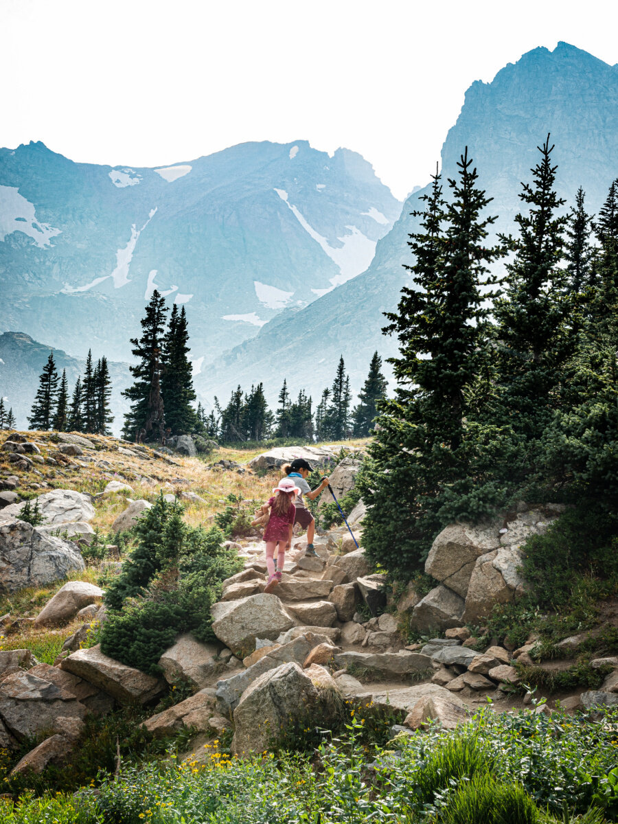
1. Mount Falcon Park: The Underrated Gem
This is your starter pack. Close. Decent climb. Views that sneak up on you. Located just west of Denver, near Morrison. You get sweeping vistas of the city skyline and the Front Range. It’s not Everest, but it’s a solid workout.
The Castle Trail loop is a good shout. About 7 miles, moderate. You’ll see ruins of an old estate. Adds a bit of morbid history. The summit offers panoramic views. Worth the sweat. Honestly, it’s a good warm-up before tackling anything bigger.
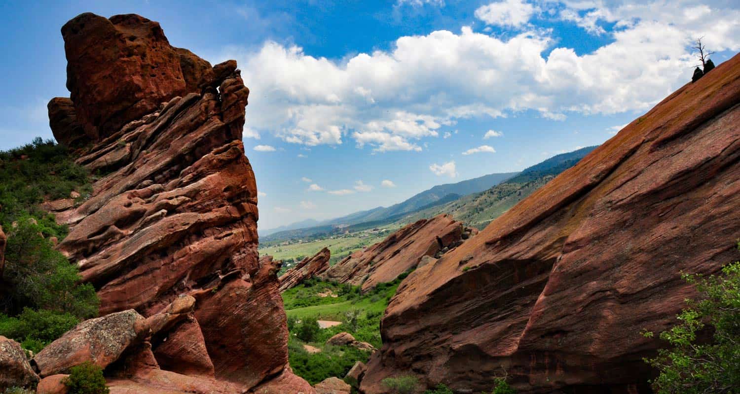
2. Roxborough State Park: Red Rocks That Aren’t The Venue
South of Denver. This place is geologically insane. Think towering red rock formations that look like they were sculpted by giants. It’s protected, so no bikes, no dogs on most trails. This keeps it cleaner, quieter. Good.
The Fountain Valley Trail is the classic. About 2.3 miles, relatively flat, but the scenery is anything but mundane. You feel like you’re on Mars. Or at least a very, very old Earth. The Waterton Canyon Trail is nearby too, longer, flatter, follows a river. Good for spotting bighorn sheep. If you’re lucky.
3. Staunton State Park: The New Kid With Big Plans
This is a bit further out, southwest of Denver. It’s newer, which means it’s less crowded than the old guard. Good trails. Serious elevation gain if you want it. Staunton has waterfalls, granite domes, and meadows.
The Staunton Ranch Trail to Chimney Rock Trail is a solid loop. Around 7 miles, moderate to strenuous. You’ll climb. You’ll see aspens in the fall. The views from Chimney Rock are killer. You can see Denver sprawling out. Reminds you why you left.
When ‘Moderate’ Means ‘Goa Hurt A Little’
Okay, you’ve done your warm-ups. Time to step it up. These hikes require more effort, better fitness. But the payoff? Exponentially better.
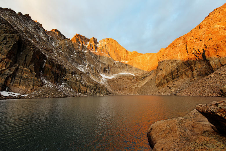
4. Mount Bierstadt: The Accessible 14er (Sort Of)
This is the gateway 14er. A 14,000-foot peak. It’s technically a Class II climb, meaning you scramble a bit, but no ropes needed. It’s popular. Too popular sometimes. Get there EARLY. Like, sunrise early. Or you’ll be parking miles down the road.
The trail is about 7 miles roundtrip. Steep. Relentless. The air thins. Your lungs burn. But standing on top of Colorado? Priceless. You need to be prepared for all weather. Snow can linger into July. Seriously. Check conditions.
Memory Lane: I remember my first time up Bierstadt. Thought I was fit. Denver fit. Colorado fit ain’t the same. About two-thirds of the way up, I was crawling. Literally. Saw a guy in a full business suit, just hiking poles. Guy was a legend. Or nuts. Maybe both. Never saw him again after the summit.
5. Chief Mountain: The Boulder Icon
If you’re heading towards Boulder, this is it. The Flatirons loom large. Chief Mountain offers a challenging but rewarding climb. It’s not technically difficult, but it’s steep. It’s rocky. It makes you work for it.
The hike up to the summit is about 4 miles roundtrip, but don’t let the distance fool you. It’s a grunt. You get incredible views of Boulder, the plains, and the surrounding peaks. It feels like you’re on the edge of the world. Be warned: it can get crowded, especially on weekends. Go mid-week if you can.
6. Herman Gulch Trail: Wildflowers and Altitude
This one’s a bit further west, off I-70 towards Georgetown. It’s a gorgeous hike, especially in July when the wildflowers are going off. It’s also a steady, consistent climb that will test your lungs.
About 7.2 miles roundtrip. You gain over 2,000 feet. The trail winds through pine forests before opening into a stuing alpine meadow. The views at the top are immense. It’s a classic Colorado high-altitude hike. Pack layers. It’s always colder up there.
The ‘Why Did I Do This?’ Category: Strenuous Hikes Near Denver
You want a challenge? You want to push your limits? Fine. These aren’t for the faint of heart. Or lungs. Or knees.
7. Devil’s Head Fire Lookout: A Stairway to Heaven (Almost)
Southwest of Denver. This hike leads to a historic fire lookout tower. The final ascent involves climbing a metal staircase attached to the tower itself. It’s exposed. It’s windy. And the views? Unbelievable.
The hike itself is about 4.2 miles roundtrip, moderate. But that final climb up the stairs… that’s the kicker. It’s not technically hard, but it’s a mental game. Looking down is… an experience. You can see for miles. Denver looks like a toy town.
Personal Anecdote: I took my buddy, Mark, up here once. He’s terrified of heights. Like, ‘can’t stand on a chair’ terrified. He made it up the stairs. Barely. Eyes squeezed shut. The look on his face when he finally opened them at the top… pure terror mixed with accomplishment. He hasn’t stopped talking about it since. Or maybe he just hasn’t stopped complaining.
8. James Peak Wilderness: Go Big or Go Home
This is for the serious hikers. West of Denver, near Rollinsville. James Peak itself is over 13,000 feet. You can do shorter loops or summit attempts. This is true wilderness. Less maintained trails. More rocks. More solitude.
The hike to James Peak summit is strenuous. Around 10 miles roundtrip, significant elevation gain. You’ll traverse rocky terrain, potentially deal with snowfields even in summer. This is a big mountain day. Requires plaing. Good gear. A solid understanding of mountain weather.
9. Bison Creek Trail to Bison Peak: Remote and Rugged
Further west, closer to Hartsel. This trail offers a taste of true Colorado backcountry without needing multiple days. It’s a long day, though. And it’s a workout.
About 11 miles roundtrip. Strenuous. You climb through forests, meadows, and eventually above treeline. Bison Peak is a prominent summit. The views are expansive. The isolation is real. This is where you go when you want to forget the city exists.
The Gear Grinder: What You Actually Need
Don’t be an idiot. You need more than sneakers and a water bottle. Especially at altitude.
The Essentials:
- Water: More than you think. Seriously. Hydration is key at altitude.
- Sun Protection: Hat, sunglasses, sunscreen. The sun is brutal up there.
- Layers: Weather changes FAST. A fleece or puffy jacket is a must, even in summer.
- Hiking Boots: Broken-in. Good ankle support. Your feet will thank you.
- Snacks: High-energy. Trail mix, bars, jerky. You’ll burn calories like crazy.
- Navigation: Map and compass, or a reliable GPS app on your phone (download offline maps!). Don’t rely on cell service.
- First-Aid Kit: Basic stuff. Band-aids, antiseptic wipes, pain relievers.
Optional but Recommended:
- Trekking Poles: Save your knees on the descents. Essential for longer, steeper hikes.
- Bear Spray: While not as common as in grizzly country, it’s still a good idea in more remote areas. Know how to use it.
- Gaiters: Keep snow, mud, and rocks out of your boots.
Altitude Sickness: The Uninvited Guest
This isn’t a joke. Altitude sickness (Acute Mountain Sickness – AMS) can ruin your hike. Or worse.
Symptoms: Headache, nausea, dizziness, fatigue. It hits everyone differently. Symptoms usually appear within 12-24 hours of ascending above 8,000 feet.
Prevention/Treatment:
- Acclimatize: Spend a day or two in Denver before heading higher.
- Hydrate: Drink TONS of water. Avoid alcohol and caffeine initially.
- Go Slow: Don’t ascend too quickly. Listen to your body.
- Descend: If symptoms get bad, go down. Seriously. Don’t push it.
- Medication: Diamox can help, but talk to your doctor first.
Trail Etiquette: Don’t Be That Guy.
It’s simple. Be decent. Leave no trace. Respect others.
- Uphill hikers have the right of way. Yield to them.
- Pack it in, pack it out. ALL of it. Trash, food scraps, everything.
- Stay on the trail. Don’t cut switchbacks. Protect the vegetation.
- Control your dog. Leash laws are usually in effect. Clean up after them.
- Be loud(ish) in bear country. Make noise so you don’t surprise wildlife.
A Little Data: Hike Distances & Elevation Gain Near Denver
Here’s a quick rundown. Numbers don’t lie. They just show you the work ahead.
| Hike Name | Approx. Distance (Roundtrip) | Est. Elevation Gain | Difficulty |
|---|---|---|---|
| Mount Falcon Park | 7 miles | 1,200 ft | Moderate |
| Roxborough State Park (Fountain Valley) | 2.3 miles | 200 ft | Easy/Moderate |
| Staunton SP (Chimney Rock) | 7 miles | 1,500 ft | Moderate/Strenuous |
| Mount Bierstadt | 7 miles | 2,850 ft | Strenuous |
| Chief Mountain (Boulder) | 4 miles | 1,800 ft | Strenuous |
| Herman Gulch Trail | 7.2 miles | 2,100 ft | Strenuous |
| Devil’s Head Fire Lookout | 4.2 miles | 1,200 ft | Moderate (Stairs = Extra!) |
| James Peak Wilderness (Summit) | 10 miles | 3,000+ ft | Very Strenuous |
| Bison Creek Trail to Bison Peak | 11 miles | 2,500+ ft | Very Strenuous |
The thing is, numbers only tell part of the story. Terrain, weather, your own fitness – it all matters. Use this as a guide, not gospel.
The Verdict: Get Out There Already
Denver’s got these killer hikes practically in its backyard. Don’t waste ’em. Get off the couch. Get some fresh air. Get some perspective. These Best Day Hikes Near Denver will give you that. And then some.
Pick one. Pack your bag. Get after it. You won’t regret it. Probably.
Frequently Asked Questions
What is the absolute closest hike to Denver?
For a true trail experience very close to the city, Mount Falcon Park near Morrison is a top contender, about a 20-30 minute drive. It offers decent elevation and great views without a huge commitment.
Are the Best Day Hikes Near Denver dog-friendly?
It varies wildly. Many State Parks like Roxborough and Staunton have restrictions (no dogs on trails or only on leash in designated areas). National Forests (like parts of James Peak Wilderness) are generally more dog-friendly, but always check specific regulations for the area you plan to visit. Always leash your dog and pack out waste.
Can I hike a 14er from Denver as a day trip?
Yes, absolutely. Mount Bierstadt is the most popular and arguably the most accessible 14er for a day trip from Denver. However, it requires a very early start (think pre-dawn) to secure parking and beat afternoon thunderstorms. Be prepared for a long, strenuous day.
What’s the best time of year for day hikes near Denver?
Late spring through early fall (May-October) is generally the prime hiking season. Wildflowers are usually best in July. Fall offers beautiful golden aspens, but be prepared for colder weather. Winter hiking is possible but requires specialized gear and knowledge, especially for higher elevations where snow can be deep and persistent.
How much does it cost to hike near Denver?
Many city and county open spaces are free. State Parks typically require a day-use fee, often around $10-$11 per vehicle. National Forest trailheads are usually free, but some popular areas or 14er trailheads might have a parking fee or require a special permit (like for overnight camping). Always check the specific park or forest service website before you go.